Inland Sea
Jump to navigation
Jump to search
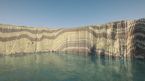
 The Inland Sea, with the tunnel in the cliff on the left | |
| Maltese | Il-Qawra |
|---|---|
| Island | Gozo |
| Type | Saltwater lagoon with a sea tunnel |
| In Minecraft | |
Coordinates
Block X / Z: -17010 / -13740 /tp @s -17010 80 -13740 | |
| In save | Gozo full (11 October 2026) |
| Real world | |
Lat / lon
36.0537° N, 14.1912° E | |
| Built from | 2012 land survey, 15 cm 2018 survey (cliffs), OpenStreetMap (tunnel mouths), photos |
The Inland Sea (Maltese: Il-Qawra) is a shallow lagoon at Dwejra, Gozo, ringed by cliffs and joined to the open sea by a tunnel through the rock. Small boats take visitors through the tunnel to the coast outside.
How it differs from vanilla
- Its own biome (Inland Sea): turquoise water, a sandy floor with patches of pebbles (gravel), and no seagrass or coral. Vanilla would give it the dark blue water and seagrass of an ordinary ocean.
- A tunnel you can row through, carved into the cliff. Minecraft never makes a sea tunnel like this on its own.
- No caves breaking into the tunnel: natural Minecraft caves near it are filled in, so the walls are solid rock and there is no sculk or dripstone inside.
The tunnel

| Part | In the world |
|---|---|
| Lagoon mouth | a tall, narrow pointed arch, about 7 m wide and 15 m high |
| Middle | narrow and tall, with a slight bend |
| Sea mouth | a wide, low cave with a flat roof along the rock layers |
| Length | about 115 m between the two cliff faces |
| Water | about 6 m deep at the lagoon end, 25 m in the middle, 15 m at the sea end |
Bring a boat. Without night vision the middle of the tunnel is dark, as it is in real life. The light at each end shows the way.
Coordinates
- On the lagoon, facing the tunnel:
/tp @s -17017 70 -13731
-
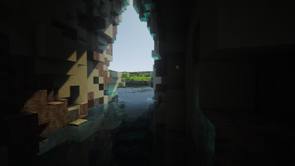 Inside the tunnel, looking back to the lagoon
 -
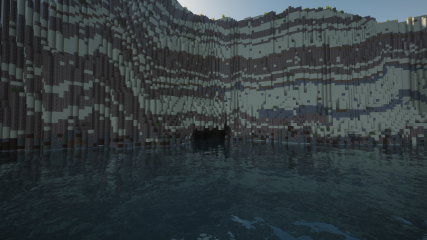 The sea mouth, from the open sea
 -
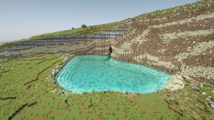 The lagoon from the cliffs


The lagoon
- Depth: 1–6 m. The land survey records the lagoon as flat ground at sea level and the seabed survey does not reach inside, so this depth is modelled, not measured.
- Cliffs: the ring of cliffs comes from the 15 cm survey of 2018, which keeps edges sharp instead of smoothing them.
- Shore: a small beach at the landward end, where the boathouses stand in real life (buildings come later).
Sources
- Tunnel mouths: on the cliff faces where OpenStreetMap maps the real cave entrances.
- Tunnel shape: modelled from photos taken from both ends and from inside.
- Cliffs: the 15 cm survey of 2018. Lagoon depth: modelled.
See also
- Dwejra: the bay, Fungus Rock and the Blue Hole
- Azure Window: the restored arch, a few hundred metres west
- Blog: Rebuilding the Azure Window and the Inland Sea tunnel